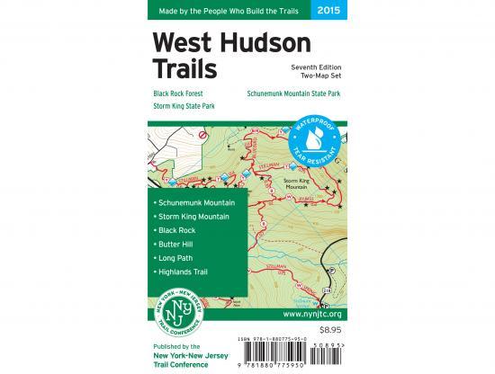

NY/NJ Trail Conference West Hudson Trails Map
$8.95
IN STOCK
Due to it's size, this item does not qualify for free shipping and has an estimated shipping charge of $3.95
Quantity:
West Hudson Trails Map - 2018 - 7th edition
Two-map set, map #s 113 & 114
West Hudson Trails Map is a two-map set featuring trails in parklands west of the Hudson River in the Hudson Highlands of Orange County, New York. The maps are printed in vibrant color on waterproof and tear-resistant Tyvek, and are a must-have for exploring these parklands in Orange County west of the Hudson River. The 2015 update includes junction-to-junction trail mileage numbers on the map front, replotted trail lines based on more accurate data, and other adjustments including a new trail in Black Rock Forest and several additional viewpoints through the maps.
- Nearly 70 miles of marked trails in Orange County, New York
- Parklands including Black Rock Forest, Schunemunk Mountain State Park, and Storm King State Park
- More than 10 miles of the Long Path and nearly 25 miles of the Highlands Trail
- Detailed trail mileage numbers
- 20-foot elevation contours
- 1:20,000 scale (1 inch = 0.32 mile)
- Convenient map sizes to carry and use on the trail
- Inset map showing a portion of Orange County's Heritage Trail
- Parkland boundaries
- Unmaintained trails and woods roads
- Viewpoints, mines, springs, and other points of interest
- Parking areas and bus stop locations
- Trail descriptions, park contact information, history, and regulations
- UTM coordinate grid