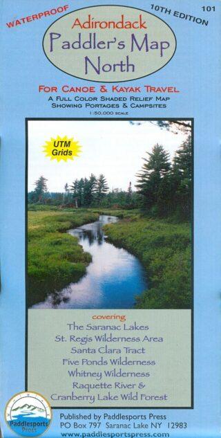
Paddlesports Press Adirondack Paddlers Map
$9.95 to $21.95
IN STOCK
Due to it's size, this item does not qualify for free shipping and has an estimated shipping charge of $3.95
Color:
Quantity:
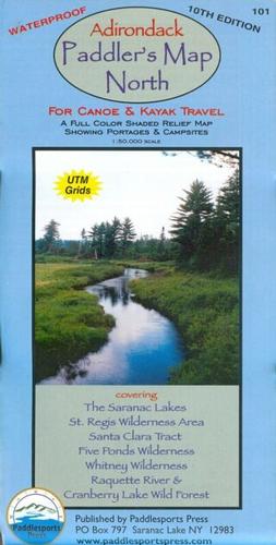
1:50,000 scale. (1”=0.8 miles) This map, now in it’s 10th edition has become the quintessential Adirondack Paddling Map.
Waterproof and tear-resistant material. Full color, shaded relief and topographic map at a 1:50,000 scale. Shows private land, state land, and wilderness designated lands, in different colors. Mountains shown in shaded relief in addition to topographic lines---map is metric. Up to date portages, trails and numbered campsites. UTM Grids. We ship the most recent edition (10th). Published in 2018!
North Covers these areas:
- Saranac Lakes
- St Regis Wilderness
- Santa Clara Tract (including the St Regis & Osgood Rivers)
- Five Ponds Wilderness (including the Oswegatchie River)
- Whitney Wilderness (incl. Lake Lila)
- Cranberry Lake Wild Forest
- Raquette River
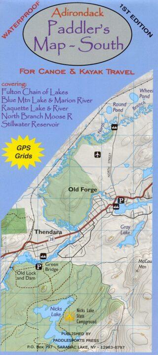
The Adirondack Paddler’s Map – South is a 1st edition waterproof map covering
- Fulton Chain of Lakes
- Blue Mtn. Lake & Marion river
- Raquette Lake & River
- North Branch Moose River
- Stillwater Reservoir